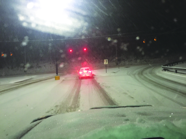
The first major snow blast of the season meant treacherous driving for motorists, such as this scene coming out of Hilltop Plaza in East Franklin Township.
Winter weather kept motorists on their toes Wednesday into Thursday.
A large system originated in Wisconsin and worked its way across the Great Lakes. As it hit Lake Erie, Armstrong County ended up with the residual effects.
It appears we could have a repeat of snow although temperatures may warm up slightly Sunday into Tuesday. With warmer temperatures, the snow could be mixed with rain and be much wetter than the last few days.
Snow flurries are expected tonight into Saturday with temperatures getting out of the teens and back into the 20’s and 30’s over the weekend.
Lee Hendricks, a meteorologist at the National Weather Service in Pittsburgh, gave his prediction for a wet Christmas this year.
“If we keep up in the pattern we are in right now, my forecast of 40% chance of snow or rain mixed with snow sounds pretty good for Christmas day!”
As we continue into the winter season, it’s important to prepare for extreme weather in both your home and vehicle.
A warm blanket behind your back seat or in your trunk is important in case you get stranded.
Make sure you have a snow shovel and ice melt at home to keep walkways clear and safe. Large 50-pound bags of ice melt are available at the Kittanning Paper office.
Check that you have sufficient heating fuel for your home and fuel for your generator, if you have one.
If you will be using a fireplace or wood-burning stove, you should have a good supply of dry, seasoned wood.
Have warm clothing and blankets on hand at home too, and stock non-perishable food items and necessary medications to last you and your family for several days.